Tuesday, July 14, 2015

Robin Hood Wrap Up


Day 18: Egton Bridge to Robin Hood's Bay

Yep, that's the North Sea!!  On this final day of the C2C we walked 17.8 miles from Egton Bridge to
the end of Wainwright's famous trek at Robin Hood's Bay. Upon arrival at about 3:00 p.m., we dipped our boots in the Bay, tossed our pebble from the Irish Sea (carried across country as is tradition) into the North Sea, signed our names in the C2C book at the Wainwright Bar in the Bay Hotel and toasted one another on a job well done.

Tallying our GPS, it looks like we walked just a tad over 210 miles.  We averaged over 12 miles a day with today being our longest and the high route into Patterdale being the shortest at 7.5 miles.

We've stayed at 16 B&Bs -- most of them very good.  If we could have another night anywhere, it would probably be the Willance House in Richmond.  Although the Manor House in Kirkby Stephen and the Butt House in Keld were top picks. What we know for sure is that to us the physical accommodation mattered much less than the kindness of the hosts.  I guess that falls in line with a favorite Maya Angelou quote, "I've learned that people will forget what you said, people will forget what you did, but people will never forget how you made them feel."  The best hosts made us feel at home in their homes and we thank them for that.

Like most C2Cers, we agree that the experience was heightened by the people we met on the trail. Although we heard over and over again that most walkers were Americans and Australians, we met only two of each (coincidently traveling together).  Most of our walking mates were from England. It also seems like the C2C is a real family affair -- lots of walking couples, siblings, two dads walking with their daughters and one father and son (then of course there were the three generations we met at Haweswater). There were also single hikers (male and female) who had their own special support networks as we all connected and tracked their progress from day-to-day (Have you seen Sarah?).

Final thought: This a very do-able hike that can be incredibly fun and rewarding with proper preparation.  Despite being called the Coast-to-Coast Walk, it is a hike and requires the fitness, gear and wherewithal that comes with some hiking experience (on multiple day trips).  Because you needn't camp or carry all your gear, daily recovery is solid.  Good map reading skills and some mountaineering experience (especially if you take the high routes in the Lake District like we did) are essential. C2Cers also can do the walk in stages (we met people who were doing the route over a number of years) or select the length of their stages in a straight run.  For us, 17 walking days felt a little slow once we got past Kirkby Stephens -- and at the same time, the pace forced us to slow down and be fully present to the experience, opportunities (like meeting fellow walkers) and photography.  We met many walkers doing the C2C in 14 days (and a couple of 12 day-ers) -- all very do-able.

When we get the final photos, I'll post once more to the blog.  At this point, we've overwhelmed the app Cliff uses to transfer photos from his camera to our iPads.

Thanks for vicariously walking with us.  It's been a blast!


Monday, July 13, 2015

Light Rain, Grouse Butts and the Ubiquitous Scone

Day 17: Blakey Ridge to Egton Bridge (12.1 miles, mostly flat track combining roads, moor paths and a lovely walk through the East Arncliffe Woods)

Rainy Walk Through Arncliffe Wood
I suppose, if you are walking England Coast-to-Coast, that there are some things that will become so commonplace as to seem ever-present.  Today what the natives tell us is the "normal" weather for the region appeared.  So, after 15 mostly dry days, a light rain drove us to don our rain pants for the first time (not counting our pre-C2C days in Scotland).  Never a soaker, the rain nonetheless slightly suppressed Cliff's picture taking about thirty minutes before we reached today's B&B, The Old Mill in Egton Bridge.  Funny, how little the rain phases us now.

And while a couple of weeks ago we were asking why the heck anyone cared about the tail feathers of a prairie chicken, today we can distinguish the butt of a grouse from a grouse butt.  We know now -- and can adroitly identify for others -- the shooting hides or blinds (grouse butts) where shooters lay in wait for the red grouse
Grouse on the moor
living in the moors to be driven in their direction (mainly by dogs, but sometimes by people on the shoot for the express purpose of flushing the grouse).  Grouse butts, short and squat stone (the really old) or wood frame structures are a common sight throughout the moors.  Sometimes they are numbered and on a rainy and windy day like today, they apparently are prime property for the sheep roaming the moors.

And if one just has walked through a rainy, windy moor (watching the grouse, spotting the grouse butts and baa'ing with the sheep), chances are very good that the first village stop will be the local tea house for a pot of tea
C2C Fuel Stop
and a scone.  The soft, doughy goodness of a scone (slathered with butter of course) is hard to beat as an accompaniment to tea.  It may be a good thing our last day of walking is tomorrow as these treats are becoming a bit of a habit - perfectly fine when one walks 5-8 hours a day. Like ale and cider for sports drinks, these little indulgences are coming to an end at the end of the road.

And tomorrow is the end of the road.  The weather forecast is fair for our final 16 miles. Already the lot of us who have been walking together for days are lamenting the loss of the simple life of the C2C: early alarm, breakfast, boots, walk, shower, pub, sleep and repeat.

Sunday, July 12, 2015

Slowly, Thoughtfully, Gratefully

Day 16: Clay Bank to Blakey Ridge (9 miles, gentle ascent followed by easy moor walking mostly across disused rail path) 

Over these three days across the moors, our walking routes are shorter than earlier on the C2C.  
Old Boundary Stone
We find we're traveling even our longer mileage days much more quickly through the gentler terrain.  And given our rhythm of B&B overnights, we are keenly aware of how much our hosts have to accomplish between our post-breakfast departure and when they must be ready to welcome the next night's guests.  Had we realized this outcome before setting out, I suspect we would have revised our schedule to add mileage to these last few days (and shorten our overall itinerary).  And I'm glad we didn't know or adjust our walking plan.  I think we're both finding the challenge to slow our pace and counter an early arrival to our next lodging a valuable presence exercise. The practice of not leaning forward into our next landing creates in each day an opportunity to be fully present in the moment.  While going hard and fast creates its own fully-present experience -- so can this deliberate slowing. Today we chose to slow our morning departure from West Cote B&B at Chop Gate and in turn enjoyed a lively lesson on the history and production of English cheeses from our hostess, Judy.  Her depth of knowledge and passion excited our conversation for miles along the path. And it made me reflect on purpose and legacy . . .

What a gift slowing can be.

Slow down and enjoy life.  It is not only the scenery you miss by going fast -- you also miss the sense of where you are going and why. ~ Eddie Cantor


Saturday, July 11, 2015

Moor, Moor, Moor

Day 15: Ingleby Arncliffe to Clay Bank (12 5 miles, up and down)

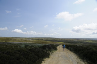
The challenge today was to hold back the pace so as not to crowd our hosts at the West Cote B&B in Chop Gate (off the trail with pick up and return so we don't miss a step of the C2C).  The 12.5 mile walk was among the loveliest of the entire walk (and imaginably dreary and endless had we suffered rain and/or mist).

We're currently in the North York Moors National Park, which is reputed to have the world's greatest expanse of heather.  While some fellow walkers didn't care for the up and down of the moors, we found the walking easy and the scenery divine.  A particular treat was seeing some of the heather in bloom.  We can only imagine how beautiful it must be when the purple flowers blanket the moors later in the season.

As it was a weekend, day trippers populated the trails around Carlton Moor, where we caught our first views of the North Sea.

North Sea on the horizon

The moors (Scarth Wood, Live, Carlton and Cringle) all have stone paths on the plateaus that keep the gait easy and encourage walkers to look as they walk (not at all the case on the ridges of the Lake District).  We saw more people than we have in days, in part because of the accessibility of the park via numerous car parks and in greater part because of the near perfect weather.  It's nice to see how much the English enjoy their parks

People and their canine companions were out in great numbers today (a Saturday).  We are thoroughly impressed with how well behaved the dogs are here and agree it has something to do with how widely accepted dogs are in different venues (from parks to shops and restaurants).  These English countryside dogs seem universally well socialized; and owners are trained to be very
responsible (we've seen posted fines for failing to clean up after one's dog fouling as high as 1,000 pounds (about $1,500 at today's conversion rate)).  Our favorite dog today was 10-week old Montgomery (perhaps smaller than Abi).

Once again there's a forecast for rain overnight and clear skies tomorrow.  With only three hiking days remaining, we are feeling quite blessed weather-wise.
Path through the moor


Breaking Trail and the Not-So-Great Day

Day 14: Danby Wiske to Ingleby Arncliffe (9.4 miles, flat)

The day started out so beautifully.  There were sunny skies and grassy paths, long hedgerows and fields of wild flowers. The mileage was low and our pace was kickin'.  We snacked on string cheese and apples on a comfortable high stile overlooking a train track.  Why we even had visions of an early pub visit and maybe a nap before dinner.  How great was this?


Maybe we should have taken heed when we passed over the stile dressed up for Halloween, complete with a skull, plastic rats and a motion-activated hoot owl.
But today, we were invincible.  After all, what could possibly go wrong?  We were traversing the lovely Yorkshire Dales, where trails are well-marked and terrain is easy.  We confidently bopped along referring only to our Stedman strip map and route markers . . . Until our trail disappeared before our very eyes (sheep trails have a way of doing that).

No problem, we'd had to shoot a corrective azimuth before.  We picked a known point on our Ordinance Survey map, set a compass heading and set out cross country (cross field in this case) to intersect dear Alfred Wainwright's path.  What pioneers were we -- breaking trail through the flora of Northern England!  The informed are nodding already, keenly aware of the proliferation of stinging nettle in the fields.  Like tiny hypodermic needles, the hairy edged leaves injected our legs (only my second day to wear shorts), with enough histamine and other chemicals to make us rue the day we set out with such reckless abandon.  Oh my gosh, how much more could this sting and how long would it last?  We soon both were covered from boot top to knee cap in burning, angry, red welts.  Arriving sheepishly at the pub, I tucked my flaming legs under a table and called our B&B for an early arrival (wondering where I could find some baking soda for relief).

So, everybody has a not-so-great day.  Having so far dodged rain, bogs and mist, we needed a horror story, and the nettles delivered.  Good thing there was no wifi last night.  Our experience in the dales is much more calmly recalled given a good dosing of antihistamine and Claritin (all downed with a Thatchers Cider, of course), followed by a perfectly lovely moor walk today.


Thursday, July 9, 2015

Although We All Speak English . . .

Day 13: Richmond to Danby Wiske (flat, easy walking)

As most of our fellow walkers (and all of our hosts) are English, we are getting a great lesson in the distinct differences in terminology between English and English:

You see: 
  • While a fry is a chip;
  • a chip is a crisp.
And
  • While a cookie is a biscuit (and it's crisp);
  • a biscuit is a scone (and not crispy at all).
And
  • While hunting is shooting (unless, of course it's fox hunting);
  • shooting may include pigeons (but they are never clay).
And
  • Quite importantly to anyone from the good old USA, while a walk is a stroll;
  • The C2C is not a stroll.  It is a hike, which is a walk (be fair warned of the Lake District).
     Short walk today (Richmond to Dansby Wiske), 15.8 flat miles.  We talked late into the evening with fellow hikers (walkers); therefore, short blog.  The photos below are of flowers and grains from English gardens and fields we passed or passed through on the day's walk.  Enjoy!


Wednesday, July 8, 2015

Richmond and Clean Socks

Days 11 & 12: Reeth to Richmond + rest day (easy walking through fields and forests, one short easy ascent)

After ten days and about 130 miles, we rambled into Richmond in North Yorkshire early Tuesday
First view of Ricmond from the hills above
afternoon.  It was our earliest arrival day yet, not at all coincidental to the two-day break Richmond promises.  Even without a calendar, I would have known we'd reach Richmond today as I unrolled my last pairs of clean socks and liners in Reeth.  While we do most of our trail washing in sinks, tubs and showers en route, the business of cleaning and drying woolen socks and liners overnight is nearly impossible.  At our B&B in Richmond, laundry service is available for a very reasonable 7 pounds!  So, as our socks dry, we're resting our feet at the Willance House in the village center.

The Willance House is the oldest remaining house in Richmond, known for the adventures of its first owner, Robert Willance, apparently remembered for having survived a cliff leap atop his horse (which, sadly, died).  The house is charming, the hosts delightful and the breakfast perhaps the best of the trek so far (how lucky are we to be able to enjoy it twice?).

Emerald C2C path through a pasture
Yesterday's eleven-mile path that brought us to Richmond was marked quite clearly and traversed easy walking terrain through a couple of lovely forests and many miles of farmer's fields.  Again I marveled at the emerald paths years of C2Cers have grooved into the fields -- encouraging drainage and keeping the path better watered than the rest of the field.  Throughout the fields the wooly Swaledale sheep continued to be our nearly constant company, now along with a hardier (noticeably stockier) breed, which has been introduced to fortify the stock.

It seems our rest timing may be quite lucky as it is raining out today.  Yesterday we experienced several showers heavy enough to cause us to take cover.  While I donned my rain jacket repeatedly, Cliff employed his trekking umbrella with ease and no small measure of flourish.  For the record, I did use my umbrella on the streets of Glasgow before leaving Scotland, but it now is nestled deep in my duffle (just feels a little awkward to me).

As you may imagine, Cliff has taken hundreds of photos at this point.  And while I've not been able to preview all of them, he does put a goodly number on a card for immediate use in the blog.  This photo of blue doors on an old farm we passed yesterday in Higher Applegarth is one of my very favorites.

For today, we're bootloose and fancy free.  More from the trail soon!

Monday, July 6, 2015

The Road Less Traveled

Day 10: Keld to Reeth

It was hard to bid farewell to Jacqui, Chris and Scamp, our warm and gracious hosts from the Butt (pronounced boot) House.  Cliff and I agreed these were hosts we would love to have as neighbors and pals.  And Scamp, well he would fit right in with the Boltz pack!

Today presented another high route/low route choice -- and having so loved the high routes in the Lakes District, we decided to go high once again.  Parting ways with many walkers at the route junction, we realized we were taking the road less traveled . . . Our route would take us high over the hills to Reeth (our destination today),  The low road in this case wound through the verdant valley below.

Before the path divided, we had the great pleasure to walk and chat with for a time with twins Jim and Peter from Birmingham, England.  The brothers have been taking long-distance walking holidays together each year since retiring (both former school teachers) in 2000.

At 70+ they were keeping quite pace, and we watched them pause at the juncture, before continuing on to the valley. Knowing Peter had completed the track before, I wondered how they made their decision as we headed up to the ruins of the 1800s lead mills above.  What did they know that we didn't?

Our high route took on altitude quickly across a rock fall, then along a lovely beck with a series of waterfalls above.  At first we thought we had the trail to ourselves.  Then we saw a group of young climbers above us, resting on a grassy area beside the falls. Continuing up the path, we met them at merged trails and learned they were all working toward their Duke of Edinburgh (D of E) award.

A voluntary program for youths aged 14-24, the D of E requires youth complete components of volunteering, physical effort, skills development, and an expedition (what the group we met were doing). Completing the program at the highest level earns participants valuable credits toward university admission.  What a great program!  We were trying to think what we may have that is similar in the US.  Maybe scouting?

Leaving the D of E group, we walked for a short time each with a couple of solo C2Cers (both English) as the day and terrain grew progressively more gray.  Winding our way through various smelt mill ruins, we finally reached the area Wainwright described as the wasteland, where the earth was left jagged and scarred from mining and quarries.

The trail trickled up and down to Reeth without much to recommend it.  Happily in the moors below the smelt mills, we saw grouse.  However, they were so fleet of foot as to be impossible to photograph on this day.  Our thought -- this is probably a good day to enjoy a valley walk, unless you have some historical interest in 19th Century mining operations!

Sunday, July 5, 2015

What Bog?


Day 9: Kirkby Stephens to Keld

Nine Standards day and it's all about the bogs, about the bogs (no trouble) -- thanks Meghan Trainor😉.  Except, due to a droughty season, there was no bog in the bog.  

The Nine Standards, a bit of an archeological mystery, are nine expertly built and irregularly shaped
cairns along a ridge in the Pennines.  Although the true history of the cairns is undetermined, one supposition (perhaps as good as any) is that the cairns were erected as decoys to worry the army of Bonnie Prince Charles.  Another, less romantic notion is that they stand as county boundaries.  Take a look, you decide.
Coming through the bogless bogs, we saw our first opportunity for a "cream tea" and having been advised never to pass one by, so indulged.  The tea was hot and the biscuit (scone), divine.  The most delightful thing about the cream tea was not the food at all, rather the enterprising family who
orchestrated the whole opportunity at Ravenseat Farm.  Our order was taken by a charming lad of six or seven years, who clearly communicated our wishes to his mum (unseen in the house and recognizable only as a female voice issuing a series of "wa, wa, wa's," much like the teacher from a Peanuts' animation).  When it came time to deliver the cream teas, our waiter became the server and his younger brother (maybe three-years) took care of the financial transaction and his sister (maybe four) took care of the bussing once we enjoyed every bite.
Short post tonight as we chatted long with our fellow hikers at dinner -- and toasted being halfway through our walk!  More from Reeth tomorrow.

In closing, my apologies to everyone who read yesterday's blog.  It was a convoluted and garbled post (not to mention the many typos).  My editor was sleeping before I published.  Regrets!

Notes for walkers:  We clearly hit a major break today by passing through the Nine Standards without the dreaded bog.  We had our gaiters and were prepared to don them (fully expected to do so).  Our thought: err on the side of being prepared as our experience seems to be the exception.  Even without the boot-sucking bog, we were aware of how fully the ground gave with each step -- signaling saturation just below the mostly dry surface.  Without the bog, this is a quick walk from Kirkby Stephen -- take your time as Keld is tiny without much going on.  We're staying the night at the Butt House, where the hospitality and food are (in our opinion) the best in the first half of the walk.  Chris is an extraordinary chef!!

Saturday, July 4, 2015

Waypoints and Walls

Day 8: Orton to Kirkby Stephens (the second "k" is silent) -- easy walking

If it's Saturday, this must be Kirkby Stephen.  Overnight it poured rain in Orton.  Between exhaustion and the weather, it was rough to get out of bed this morning.  

Nonetheless, we toasted US Independence Day and the start of our second week on the Wainwright Trek with orange juice at breakfast; then hoisted our packs, tied on our boots and set out into a cloudy but rain-free morning.   The terrain, again gentle and rolling, supported a rather brisk pace.

Combining the guidance from our Stedman C2C Book with signage and the occasional grid check, we chatted merrily across pasture lands, over country lanes and along stone walls . . . until that whole question about hugging the wall where the power lines crossed the path gave us pause.
Those wires looked much closer in the book . . . Holy smokes, could we really have wandered so far afield?  No worries, we determined our current location, Cliff shot a corrective azimuth, then we hustled cross country, climbed a stone wall and were back on track in short order.

Look Georgie, more wall-huggers!
Turns out, we had lots of company in this detour -- at least three other groups missed the critical turn -- much to the amusement of the locals.

What we know for sure is that while this walk is billed as 192 miles coast to coast, we're going to end up with more miles (how many more -- to be determined) between "detours" (a euphemism if ever there was one), diversions to lodging, finding the perfect view/lunch spot/personal relief point, etc.  And you know what? We're good with that.


We're happy.  Really happy.  We're blister free.  We're walked out at the end of each day, eating with gusto and sleeping like babies.  We're enjoying every day, grateful for the time, physicality, motivation and means to walk.  And we're learning something about ourselves and one another everyday.

Note: While this blog so far has basically been a series of "letters home" written to those we invited to follow us, we are aware of a larger following, so beginning tonight (and backtracking to add information to previous posts) we're adding information that may be helpful to others considering/preparing for this trek.   It's a way of giving back since we harvested so much valuable info from other C2C blogs to help us to plan our trip.

Orton to Kirby Stephens (vs Shap to Kirby Stephens) breaks up what can be a very long day.
Route Tips: (1) Use OS maps with vigilance as Stedman Book may be confusing just beyond Bents Farm, (2) pack a lunch (there are no villages en route).


Friday, July 3, 2015

Just Like All Those Pictures You See In the Brochures

Day 7: Bampton to Orton (easy walking through fields -- great day to picnic if the weather is good)

Today was the brochure-perfect walking day.  Clear skies, rolling hills, fields of buttercups, a lunch of local cheese, bread and apples in a farmer's field.  We took our time and the trip photographer took picture after picture to capture the day.  He got photos of Andy and Colleen from Lincolnshire. Backpacking happily without a timeline, they were both bright and shiny as new pennies.  He got photos of the Shap Abbey ruins with relics ranging from 1200 - 1550 -- to include the mostly intact West Tower and stores.  The history boggles the mind.  He got umpteen photos of sheep and lambs, landscapes and flowers, even an RAF fighter jet exercising overhead.  He got pictures of finger posts and the vivid emerald green stretch of the rutted C2C path across newly mown fields.  This was a day made to be photographed . . .

And to see those photos, you'll have to check back in a few weeks, because today the photographer's camera "got away from" him (his words not mine).  Nothing was formatted for the blog.  Whaaaat? So instead of Cliff's pictures, tonight I offer my iPhone photos, where my only job is to capture snaps of the photographer (to prove the man behind the camera was really there!). Note the beautiful blue skies . . .

Photographer Adjusting his Boots

Photographer Crossing a Stile

Photographer, No Explanation Required


At this point (after a 13-mile day -- all without the much-touted bog), we've stopped for the night in the tiny village of Orton -- known for its church (dating back to 1293), chocolate factory and old village charm.  Our B&B is a restored barn house built in 1854.  And yes, the pub had our favorite sports drinks on tap! We're heading now toward Yorkshire, where my mind runs wild with Yorkshire farm images from the 1970s books by James Herriot.

Thursday, July 2, 2015

Leaving the Lakes

Day 6: Glen Ridding to Bampton (combination of paths along grassy trails and adjacent to Angle Tarn and Rocky climb up to Kidsty Pike -- moderate to easy)

Having read the guidebook descriptions regarding today's walk from Glen Ridding to Bampton, I set out this morning ready to cross the highest point on the original C2C walk (excluding those alternate high routes we've been taking) and to crab walk the greatest descent.  Both knees taped, iPod charged, two poached eggs for breakfast -- I was set!  Into the mist we ventured -- our objective: Kidsty Pike. And what I know now is that those walkers who have stuck to the original route (no high alternatives), have been having a very different experience from us.  The day was the easiest yet. Fourteen miles, 4,400 feet of mostly gradual ascent and a downhill so gentle and grassy that I could (and did) run part of it.
Rolling Descent from Kidsty Pike to Haweswater Reservoir
To our Scottish clan: this was NO proper Scottish descent! (Marianne, you would have loved it!!).  We agree that the high route alternatives are must dos.  They are absolute gems with treasured views.  And if we'd put all of our "view eggs" into this morning's misty basket, it would have been a shame.

The last day in the lakes also delivered a couple of surprises.  For one, the Herdwick sheep disappeared and the comically white-faced Swaledale sheep took their place.  For another, turns out I've learned to speak sheep and my baa'ing can not only get them to look at the camera, they actually baa back!

Swaledale Sheep
Another (pleasant) surprise: as we reached the headwater of the Haweswater Reservoir below Kidsty Pike, the C2C signposts (basically banned in the lakes) reappeared -- but not before one last misty morning of compass bearings and waypoint-to-waypoint navigation using our Garmin GPS to find the Pike.

As for company, in the mist at Angle Tarn we came upon Ian and George, father and son C2Cers from Manchester England who are walking together following George's recent completion of exams. Although they professed little experience, they kept a steady pace and we saw them several times throughout the day.

Ian and George in the Mist
And on the fairly monotonous trail around Haweswater, we came upon John and Toby -- another father and son team.  John though, was doing the real work as Toby enjoyed the ride.
Toby's first C2C
Immediately behind the duo were Toby's mum and grands. Turns out the grands had done half the C2C five years past. Today they were walking east to west to take on the Lakes. We wished them clear skies and happy days -- take the high routes if you can.

Happy Knees on the last Lake District Day


Wednesday, July 1, 2015

High and Hot

Day 5: Grasmere to Glen Ridding (another high route laborious ascent, VERY steep descent from St Sunday -- note the books all warn of the winds on St Sunday and it was fierce this day)

O.K., so the title of today's post actually sounds a tad more intriguing (depending on how your thoughts run) than the reality of the day.  With the last high-route alternative selected and complete (although not the highest by ~300 ft as we agreed upon St Sunday Crag over Helvellyn to spare my screaming knees), in temps that reached 96F, we're settled into Glen Ridding for the night. Glen Ridding is a tiny village -- mostly a series of small cottages sprung up around the picturesque Ullswater.

Sweating in our room right now, it's hard to believe that there was a time in our walk planning when we became slightly preoccupied about drying rooms and cozy fireplaces in pubs (ha!).  Now it's: "Pass the sunscreen," and, "Why don't these rooms have ceiling fans?"  Knowing the weather likely will change at some point over the next 13 days, for now we're quite happy with clear skies.

By now we figure you've got to be bored reading about us. We're bored writing about us!  To liven things up, we've decided to introduce some of the people we're meeting along the way.  Really, I wish we'd done this earlier so you could get a sense of the proud sheep farmer and his dog, Lad, on Dent Fell; or of Rachael, the chatty innkeeper with her 20-year-old Cockatoo, Pip, in Longwaithe.  As luck would have it, we set this intent today, then had the trail mostly to ourselves.  Note that for many walkers this is a 17-mile day.  Given the distance, most elect to walk the valley paths and appear much later in the day.  For us, this was our shortest leg at just under eight miles.  Still, we did meet three people (and MANY sheep) along the way:

At the top of The Cape (the high point on St Sunday Crag with the best panoramic view on the C2C), we met John and Ken, two hiking buddies out for a day trip.  Both of these charming Englishmen proclaimed their love for the Lake District, enthusing over the views, the challenge and (today at least) the weather.  So smitten are they that each recently has taken up residence in the District.  They were interested to learn we were walking the C2C.  John told us he has completed the trek several times.  Lamenting  that we would soon be leaving the beauty of the lakes, he quickly added that Yorkshire would be a real treat.  Cliff took their photo; and John was nice enough to snap a shot of us before we headed down hill (oh the knees!).

As I channeled my best inner fiddler crab -- dodging drops and testing rocks in a slow downhill zigzag, Cliff continued his sure-footed mountain goat descent ahead.  At some point I became aware of a rapid, light-footed descent behind me.  Mark, from Stirling, Scotland (think BraveHeart) was on mile 12 of a loop that included not only St Sunday, but also Helvellyn -- all at a full-out run mind you!  Mark was nice enough to allow us to take his photo, and to stop and chat about Scotland and our recent visit there (and to act suitably impressed with our five munros).  He was enjoying the sun and warmth of England -- having left one of the coldest and wettest summers on record at home (don't we know!).  Within minutes (ok, maybe a minute) of bidding us farewell, Mark sprang effortlessly out of sight.  And my crab walk continued . . .

Mostly though today, we were surrounded by our near constant companions in the Lake District, the distinctive Herdwick ewes with their adorable black lambs.

Tuesday, June 30, 2015

Sports Drinks Redefined

Warning: For anyone curious as to the veracity of these blog reports, please know tonight's sports recovery drink was NOT Gatorade G2, rather fine British Ale and Cider (fine = available at the local pub).  I'm not sure yet how well this new habit is going to translate to arriving home from the gym at 10:30 a.m. in the future . . . probably not at all!

*********
Days 3 (Ennerdale Bridge to Longstraithe) and 4 Longstraithe to Grasmere) -- both high routes in the Lakes District -- rocky paths with steep ascents and sharp, rocky descents

No posting last night as our B&B in Longstraith had no connectivity (wifi or cellular).  Today catches us up in Grasmere.

Today (30 June), like yesterday, required we choose our route: low or high.  In both cases we chose the L- L-L- . . . High routes.  For anyone considering this trek, we highly recommend the high routes in good weather (clear skies and high ceilings).  The views are AMAZING!!

Lake Buttemere from High Stile
Ennerdale Bridge to Longstraithe: The effort is considerable, though, especially layering high routes over consecutive days.  On 29 June we decided on the high route, which added about two hours to our 15.8 mile walk and delivered 5,000 feet ascent and descent. This high route includes the highest point on the C2C (High Stile), and was such a favorite of Wainwright that his ashes are scattered here (the Haystacks).  In his famous guide, however, Wainwright described the route as only suitable for "very strong and experienced fellwalkers" (in clear weather).  And it was a tough day (seriously I was heard to gasp, "and I thought I was in shape . . . ,"); and particularly windy and cold at the top . . . but totally worth the work.  Note to hikers: the route up to Red Pike is steep and poorly marked.  I resorted to Stedman's recommendation to progress straight up in the absence of the trail as the lateral routes are dangerous given shale scree and loose rocks. 

. . . And slow learners we are, today we were up for the high route again.  While not half the challenge of yesterday, we seemed to be the only C2Cers on the high route today.  Many C2C hikers seem to skip the high route on this leg for speed (headed to Patterdale) or to allow legs to recover from the previous day. Much shorter (just under ten miles), with half the elevation gain (and loss) of the day before, it's a very do-able route.  Notably, we met one exceptionally charming septuagenarian chugging up the crags today who, having reported completing the C2C twice, raised an eyebrow at our decision to hit the high routes on the C2C.  Perhaps we had that novice look??
Looking down on Grasmere from Helm Crag
At any rate, today we hit Calf, Moment and Helm Crags before make the steep descent into the lovely Lake District resort village of Grasmere for the night.  Grasmere is notable as the home of poet William Wordsworth -- Laureate of the Lakes District -- (and for its traditional gingerbread and fine sports drinks 😉, the former of which we've tucked into our packs for a trail snack tomorrow -- alas the rehydration will have to wait until we're off trail for the day!).

Good news ahead: the sunny warm weather is forecast to hold -- so tomorrow we're heading for Glen Ridding and high route #3 . . . 

Sunday, June 28, 2015

Following Wainwright -- The Invisible Fell

Day 2: St Bees to Ennerdale Bridge (some fell walking, boggy with stream crossings)

Eastward Ho!
This morning we set out again from St Bees, rejoining the path at yesterday's point of departure
around mile 6.5.  Although our on-and-off approach earned us 19 miles on a 15-mile leg, we agree it was a sound decision to get the feel of the trail (feet and brains) by kicking off early.  We set out in the rain today through grassy fields that validated our C2C fashion ensemble of rain jackets, rain hats, shorts and gaiters.  Cliff (above) was more than happy to strike a catalog pose with the C2C monument at mile 7.

There's a feeling one gets, churning one's way to the top of a fell (mountain) in a blinding mist, that falls somewhere between hesitate elation (hallelujah, we've made it to the top (we think)) and outright exasperation (so we suppose we've made it to the top because the gasping uphill has ceased and the bone-jarring descent is underway).  Such was our experience over Dent Fell today.  The photo to the left was taken just after the summit.  You can see from my stairway to the clouds (actually a very tall deer stile), that our misty walk continued into early afternoon. Luckily, since Alfred Wainwright's Coast-to-Coast trek first was published in 1973, navigation greatly has been enhanced by satellites and signals. And grateful were we for the validating electronic burps issued from the GPS at the top of the fell, because with zero visibility terrain association was pretty much out of the question. It was all waypoints, compass headings and distances across the invisible fell.

All said it was day of steadily improving weather as we made our way through woods (incredibly dense and dark), over the (misty) fell and across a series of boot-soaking fords before the sun finally made its appearance just before we reached Ennerdale Bridge (and our B&B for the night) mid-afternoon.
Coming into Ennerdale Bridge
Out of the Clouds